I start at the point where Coyote Creek first crosses paths with Hwy 434,near Black Lake Resort. I'm still trying, sporadically, to figure out the local geology. In a nutshell, 434 traverses Jurassic, Triassic, Permian, Pennsylvanian, and Missipian seds in the south end of Moreno Valley, to (?) Pig-Nog and Quaternary basalts in Guadalupita Canyon, to Precambrian metamorphics on the west side of the Crestone anticline and more JTPPM on the east past Guadalupita, once you get to the flat (more or less). The Crestone is a near-vertical outcrop of JTPPM along one of the main Sangre de Cristo uplift faults, the Romero Fault. It extends from near Guadalupita south to past Las Vegas (the other one) and transitions from the Romero Fault to the Hermit Peak Fault. It's a way cool structural feature of the landscape and characterizes the drive north from LV to Angel Fire, at least for me.
 This is where Coyote Creek first encounters 434, one of many xings. We (colleagues and me) think its a Rosgen E in these parts. In most locations (where it hasn't been messed with), it has that classic E shape, with overhanging banks great for the fishes to hide under. [Can you tell I'm not a fish squeezer?]
 Even with big-ass culverts (in non-scientific parlance), the creek is backing up and flooding.
 The other side of the big-ass culvert xing. Channel has a more normal shape. Downstream of this, there's a stocked, dammed pond in the Black Lake Resort property. After the dam, the creek returns to a slightly degraded E, but we're making sure it gets a little TLC.
Between here and the next photo, Coyote Creek starts dropping through the inaccessible canyon, turning into much of a step-pool stream.
 After the primary gradient drop, the stream again interweaves with 434. Here, north of the state park, the stream is clearly reaching bankfull. Spring runoff at its best!
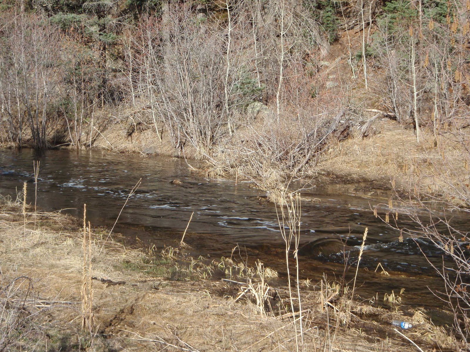
 Beavers are busy. Still above the park, but right next to the road. If flow increases, NMDOT might have a problem.
  Just downstream of the state park, the valley widens (out of the volcanics and into seds on the east). This view shows the extensive willows/wetlands in the valley.
 Saying goodbye to Coyote Creek as it goes through a water gap in the Crestone. Not sure of the formation forming cliff in distance. May be Glorieta SS, from map in NMGS 1990 "Tectonic Development of the Southern Sangre de Cristo Mountains." As there's no topography in the map I've been examining, it's difficult to tell.

1 comment:
How come the shaded-relief map of the Crestone (on Google Maps) looks sooo much like a small-scale version of the Appalachians? Is the Crestone the remnant root of an ancient range, like (I've heard) the Appalachians are?
Post a Comment