On Monday, I had all day meetings in Angel Fire. The drive up was beautiful, as the east side of the Sangres always is. Fortunately, I had enough time on the drive home to stop and take pictures of Coyote Creek reaching bankfull during the spring freshet.
I start at the point where Coyote Creek first crosses paths with Hwy 434,near Black Lake Resort. I'm still trying, sporadically, to figure out the local geology. In a nutshell, 434 traverses Jurassic, Triassic, Permian, Pennsylvanian, and Missipian seds in the south end of Moreno Valley, to (?) Pig-Nog and Quaternary basalts in Guadalupita Canyon, to Precambrian metamorphics on the west side of the Crestone anticline and more JTPPM on the east past Guadalupita, once you get to the flat (more or less). The Crestone is a near-vertical outcrop of JTPPM along one of the main Sangre de Cristo uplift faults, the Romero Fault. It extends from near Guadalupita south to past Las Vegas (the other one) and transitions from the Romero Fault to the Hermit Peak Fault. It's a way cool structural feature of the landscape and characterizes the drive north from LV to Angel Fire, at least for me.

This is where Coyote Creek first encounters 434, one of many xings. We (colleagues and me) think its a Rosgen E in these parts. In most locations (where it hasn't been messed with), it has that classic E shape, with overhanging banks great for the fishes to hide under. [Can you tell I'm not a fish squeezer?]

Even with big-ass culverts (in non-scientific parlance), the creek is backing up and flooding.

The other side of the big-ass culvert xing. Channel has a more normal shape. Downstream of this, there's a stocked, dammed pond in the Black Lake Resort property. After the dam, the creek returns to a slightly degraded E, but we're making sure it gets a little TLC.
Between here and the next photo, Coyote Creek starts dropping through the inaccessible canyon, turning into much of a step-pool stream.

After the primary gradient drop, the stream again interweaves with 434. Here, north of the state park, the stream is clearly reaching bankfull. Spring runoff at its best!

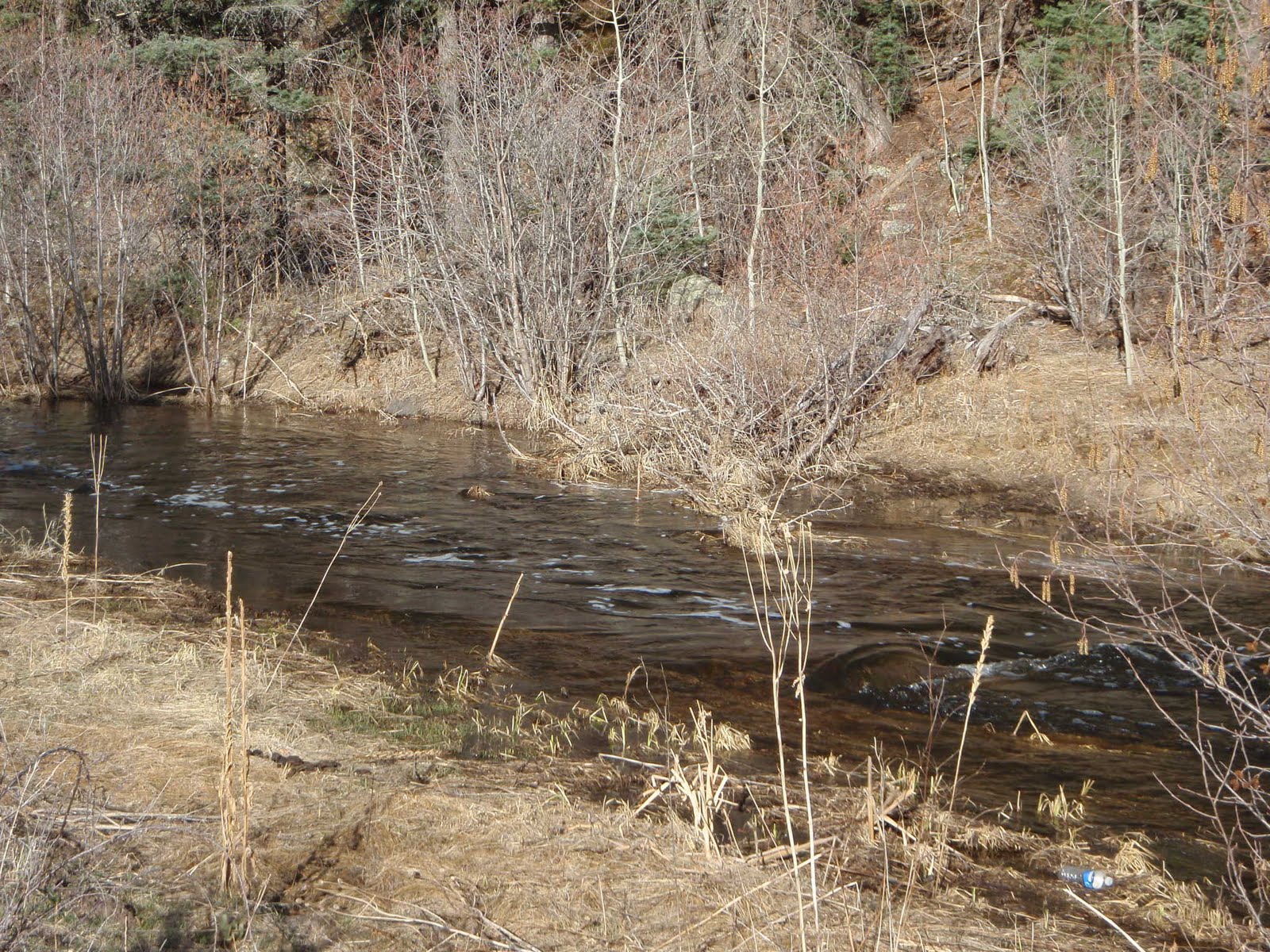
Beavers are busy. Still above the park, but right next to the road. If flow increases, NMDOT might have a problem.

Just downstream of the state park, the valley widens (out of the volcanics and into seds on the east). This view shows the extensive willows/wetlands in the valley.

Saying goodbye to Coyote Creek as it goes through a water gap in the Crestone. Not sure of the formation forming cliff in distance. May be Glorieta SS, from map in NMGS 1990 "Tectonic Development of the Southern Sangre de Cristo Mountains." As there's no topography in the map I've been examining, it's difficult to tell.
 IMHO, this doesn't work as an energy dissipation stucture. One ends up with bale structure material floating downstream for redeposition (and remobilization, and repeat over and over until said bale structure material is either in the ocean or a reservoir).
 Mid to late March, looking west at the upper Sangre de Cristos. There was snow down to between 8-9K feet. It's now between 9-10K feet, with bare stone showing on most of the high peaks. Most of the lower snow is now gone, and we've reached, essentially, the early low snow peak runoff. Many of the streams draining the Sangres have reached near bankfull. It's hard to tell what the rest of spring will bring. A hard warm rain on the remaining snowpack will bring a rapid peak; a gradual rise in temp from now til June will slowly melt the remainder. All the folks I talk to prefer the latter. Better for towns with constrained streambanks, better for farmers dependent on acequias to water their fields, better for the riparian habitat to thrive through summer.
  Last week, I visited a very overwound meander on El Rito de la Vaca. We all stood around and scratched our heads about what to do, and we included a geologist, stream ecologist/geomorphologist, aeronautical engineer, and local rancher. A fire a few years back resulted in floods that dumped a boatload of sediment in the valley, messing with equilibrium and setting this meander up for an avulsion. This would create some awful problems for the rancher, including wiping out his only access as well as the forest road providing the main valley access. The final result? We said to contact the head of the local watershed group and get recommendations for a good hydrologist skilled in natural channel design work who can carefully evaluate the reach and design an appropriate solution. Maybe the watershed group can come up with a grant project (there's one more overwound meander just like this immediately downstream) to help defray the costs. And yes, it was snowing.
 Last, this is the first Persian tulip to flower in my yard this spring. I wasn't in Iran early enough ten years ago to see the native tulips bloom, and haven't had the chance, until this last fall, to plant any. I'm awfully excited that they're blooming and that spring is really, truly finally here.